Bulbs
Flower Basics
Flower Beds & Specialty Gardens
Flower Garden
Garden Furniture
Garden Gnomes
Garden Seeds
Garden Sheds
Garden Statues
Garden Tools & Supplies
Gardening Basics
Green & Organic
Groundcovers & Vines
Growing Annuals
Growing Basil
Growing Beans
Growing Berries
Growing Blueberries
Growing Cactus
Growing Corn
Growing Cotton
Growing Edibles
Growing Flowers
Growing Garlic
Growing Grapes
Growing Grass
Growing Herbs
Growing Jasmine
Growing Mint
Growing Mushrooms
Orchids
Growing Peanuts
Growing Perennials
Growing Plants
Growing Rosemary
Growing Roses
Growing Strawberries
Growing Sunflowers
Growing Thyme
Growing Tomatoes
Growing Tulips
Growing Vegetables
Herb Basics
Herb Garden
Indoor Growing
Landscaping Basics
Landscaping Patios
Landscaping Plants
Landscaping Shrubs
Landscaping Trees
Landscaping Walks & Pathways
Lawn Basics
Lawn Maintenance
Lawn Mowers
Lawn Ornaments
Lawn Planting
Lawn Tools
Outdoor Growing
Overall Landscape Planning
Pests, Weeds & Problems
Plant Basics
Rock Garden
Rose Garden
Shrubs
Soil
Specialty Gardens
Trees
Vegetable Garden
Yard Maintenance
How to Measure Elevation for Water Drainage Projects
How to Measure Elevation for Water Drainage Projects. When planning and making runoffs for water drainage, it is important to have an understanding of elevation change to allow the water to adequately drain. After determining which way the water should drain, one should have an accurate understanding of the elevation changes from one point to...
When planning and making runoffs for water drainage, it is important to have an understanding of elevation change to allow the water to adequately drain. After determining which way the water should drain, one should have an accurate understanding of the elevation changes from one point to another, as well as relative to a benchmark, to find the most efficient way to direct the water. The way surveyors accomplish this is with a transit. The transit is very accurate, but the price and availability may prohibit its use. Nevertheless, there is an easy, economical way to measure elevation changes, using flexible tubing and water, that has been around for thousands of years.
Things You'll Need
Clear, flexible tubing
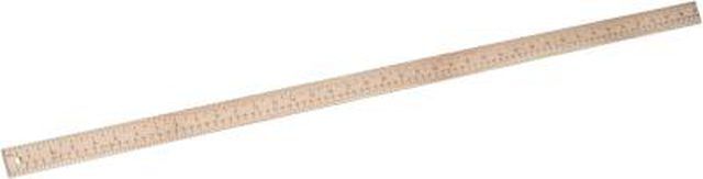
Yardstick
Water
Go to a landmark or benchmark in the area where you would like to measure the elevation. Place a stake or pin at the location. This is the point of beginning.
Unroll the flexible tubing, hold both ends of the tubing, and fill one end with water. Continue filling the tube until the water is nearly to the top of both ends. Fix one end of the tubing to the stake or a rod at the point of beginning. Measure the vertical distance from the surface of the water to the ground.
Carry the free end of the tubing to the location where you would like to find the elevation. Measure the vertical distance from the surface of the water to the ground at the location in question. Find the difference between the measurement at the point of beginning and the second location's measurement. This difference is the change in elevation between the two points.
Measure the horizontal distance between the point of beginning and the second elevation. With this information, one can find the slope using this formula: slope equals elevation change divided by horizontal distance. Use the slope to determine the best method for water drainage on a property. The path of drainage should be a continuous slope or steepen as the water descends.


